Mountaineering & Hiking / 登山とハイキング
Mountaineering & Hiking in Japan
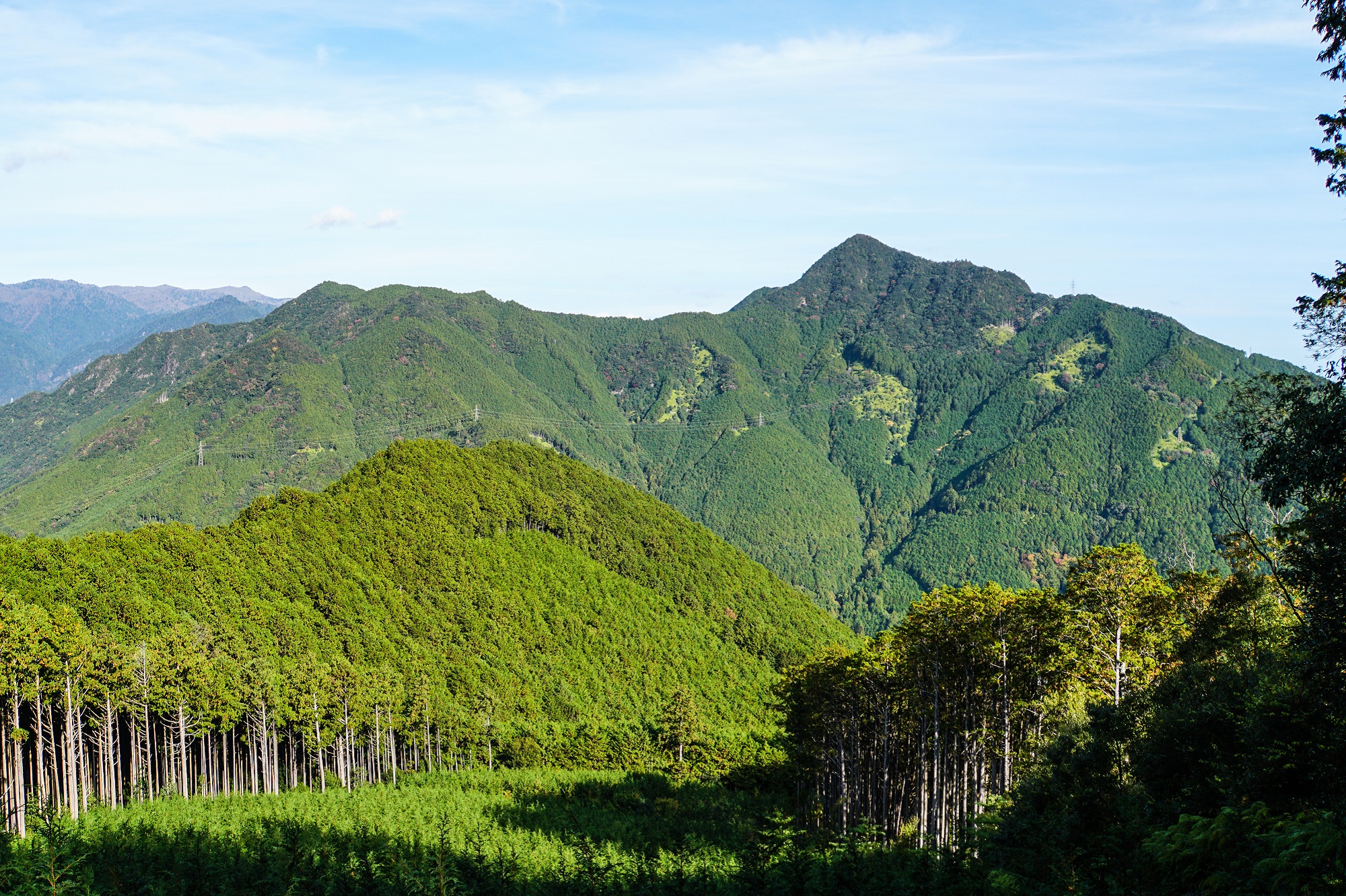
The land of Japan is covered with about 70% in forest and there are countless spots to enjoy mountain climbing and hiking. The mountains, valleys, flowers, sunsets and sunrises, and star-filled skies will make you immerse in rich nature and experience your journey like never before. If not familiar with climbing mountains regularly, hiking is recommended instead. Many hiking trails are much easier to complete than summit a mountain, and even first-time hikers will be able to enjoy this outdoor activity with the minimal equipment reassured.
Preparation for Mountaineering & Hiking
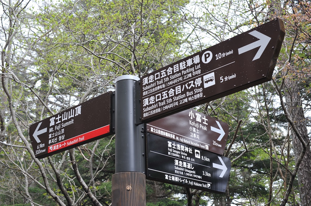
Outfits for mountaineering are different from the daily clothing. Prepare your outfits for extreme temperature fluctuation and the time for walking and bring some extra clothes to adjust the body temperature and choose clothes that dry quickly in case of perspiration or rain. Hiking shoes, backpack and rain wear, and ample supply of food and water are also recommended to be packed. Other necessities vary on the specific destination, so check and prepare accordingly and plan with care. In case of mountain climbing, submitting a mountaineering application is required. The method of submitting the document differs by region, so please check in advance.
As for hiking, there are easy-to-walk courses with little elevation change, also enjoyable even for people that are not hiking regularly. Although not as much equipment is required compared to climbing mountains, be sure to wear clothes that quickly dry and are adjustable to the body temperature in case of getting wet from perspiration or rain. Also, wear comfortable shoes and a suitable backpack, and bring rainwear and sufficient food and water, just in case of unexpected change in weather or if there are no stores or restaurants along the route.

Tips to Enjoy Mountaineering & Hiking
Mountain climbing and hiking are even safer when considering of the fellow lovers of the Great Outdoors. Here are some basic rules and etiquettes to enhance the experience.
Basic Rules and Etiquette for Hiking and Climbing:
-Greet others when passing
-Overtake only at the pace of person in front of you
-Yield the way to the person ascending on a trail
-Leave no trace - do not leave anything behind you
-Leave the flora in its natural place
-Do NOT touch or feed the wild animals
-Do NOT even take a pebble home with you
-Be aware of falling rocks - and do not cause them
In addition, please be sure to follow the common rules to stay away from the prohibited areas, take a portable toilet in case the restrooms are not available, stay on the wooden paths or pavements if there is one, be extra careful not to cause any accidents, and take special care of others when taking pictures. Above all, remember that certain locations may have individual rules, so, check in advance and follow them.
Recommended Sites for Mountaineering & Hiking in the Chubu Region
Aichi
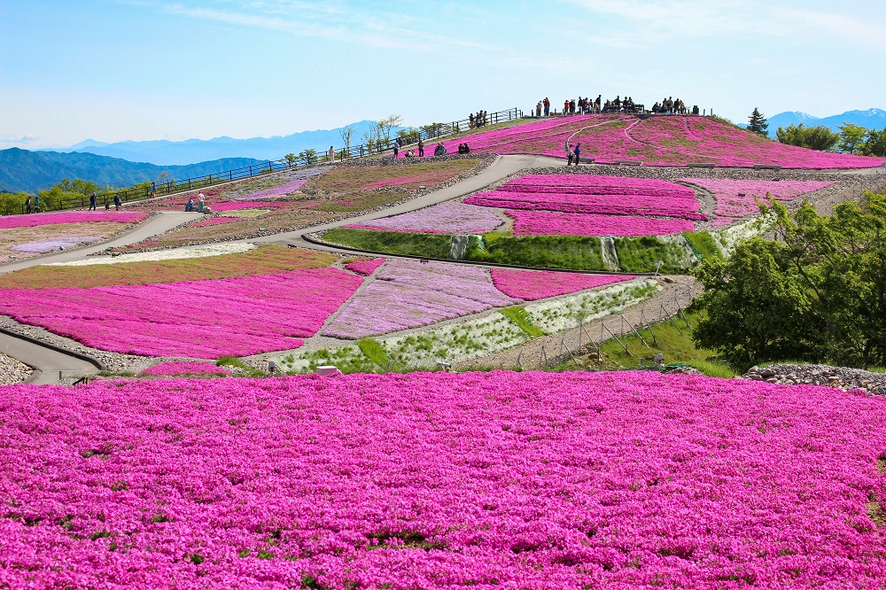
Chausuyama Highlands (Toyone Village, Kita-shitara County)
Chausuyama Highlands spreads out on the highest mountain in the Aichi Prefecture Mt. Chausu, at 1,415 meters above sea level, and Mt. Hagitaro, located to the south of Mt. Chausu, at 1,358 meters above sea level. In the springtime, "Shibazakura no Oka" [moss phlox hill] bursts out in all its glory near the summit of Mt. Hagitaro, with as many as 400,000 moss phlox in full bloom. In winter, the highland turns into the one-and-only ski resort in the Aichi Prefecture.
Shizuoka
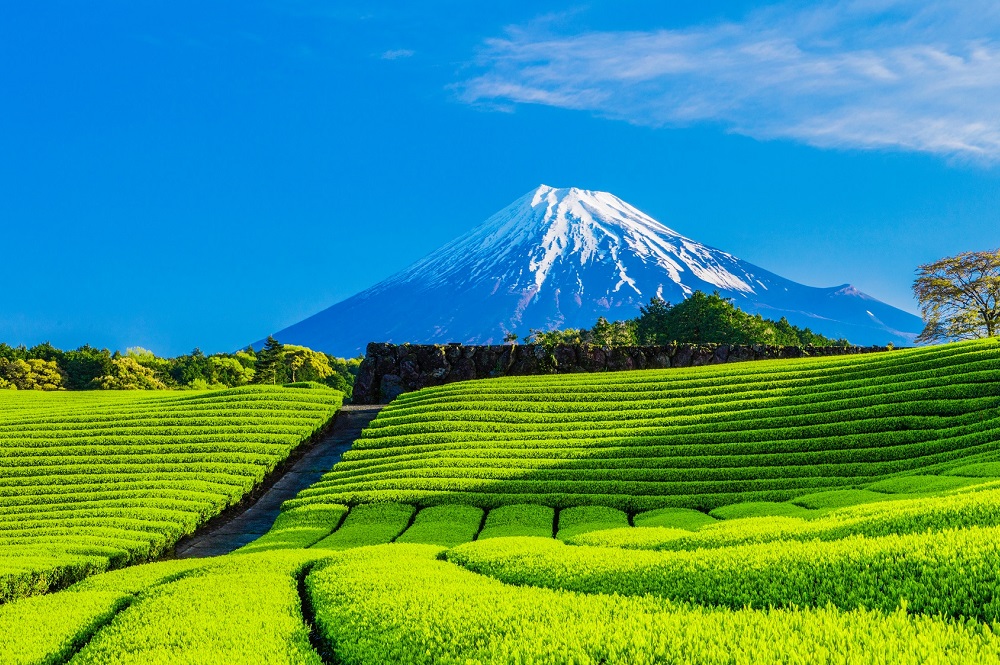
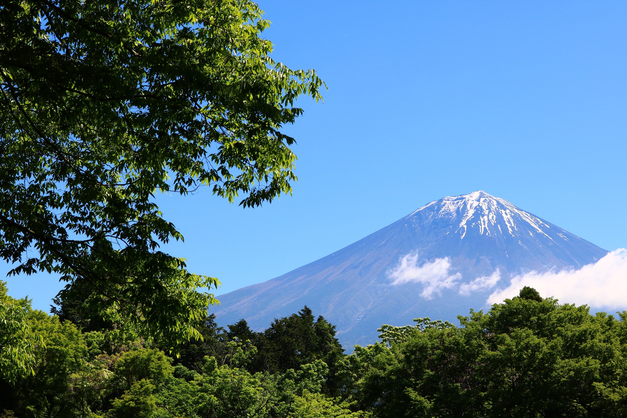
Fujisan [Mt. Fuji] (Shizuoka Prefecture and Yamanashi Prefecture)
Mt. Fuji is the highest mountain peak in Japan with the elevation of 3,776 meters. The Kanto Plain, Hakone, Izu, the Southern Japan Alps, The Northern Japan Alps, and the Yatsugatake Mountains may be seen from Mt. Fuji. Watching the sunrise from the summit will be a touching experience guaranteed. To reach the summit of Mt. Fuji, keep in mind the oxygen level which is about two-thirds of the mounting foot, and the temperature drops by about 20℃. Also, altitude sickness may cause headaches, nausea, fatigue, and other symptoms. Plan adequately, equip accordingly to climb Mt. Fuji. The "Fujinomiya Route" starts at the highest elevation and is the shortest distance to the summit, however, there are steep sections and may be crowded due to the fact that ascending and descending routes are the same one and may be difficult to climb. Also, it is highly recommended to spend a night at the lodge according to the fitness level, also well in advance reservations are recommended because of the high demand.
Click here for more on Mt. Fuji
Nagano
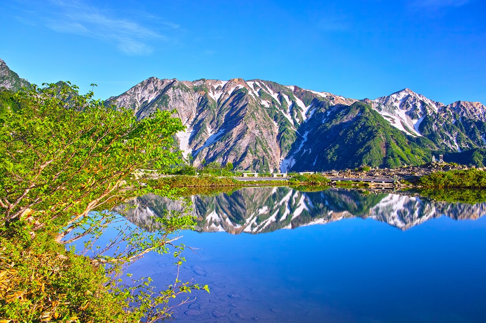
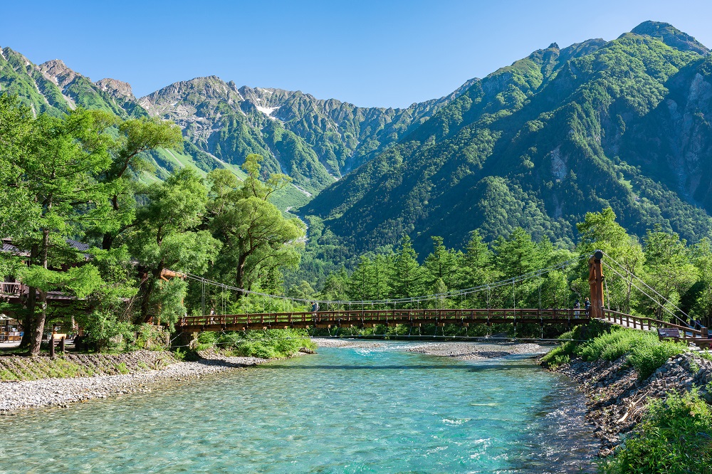
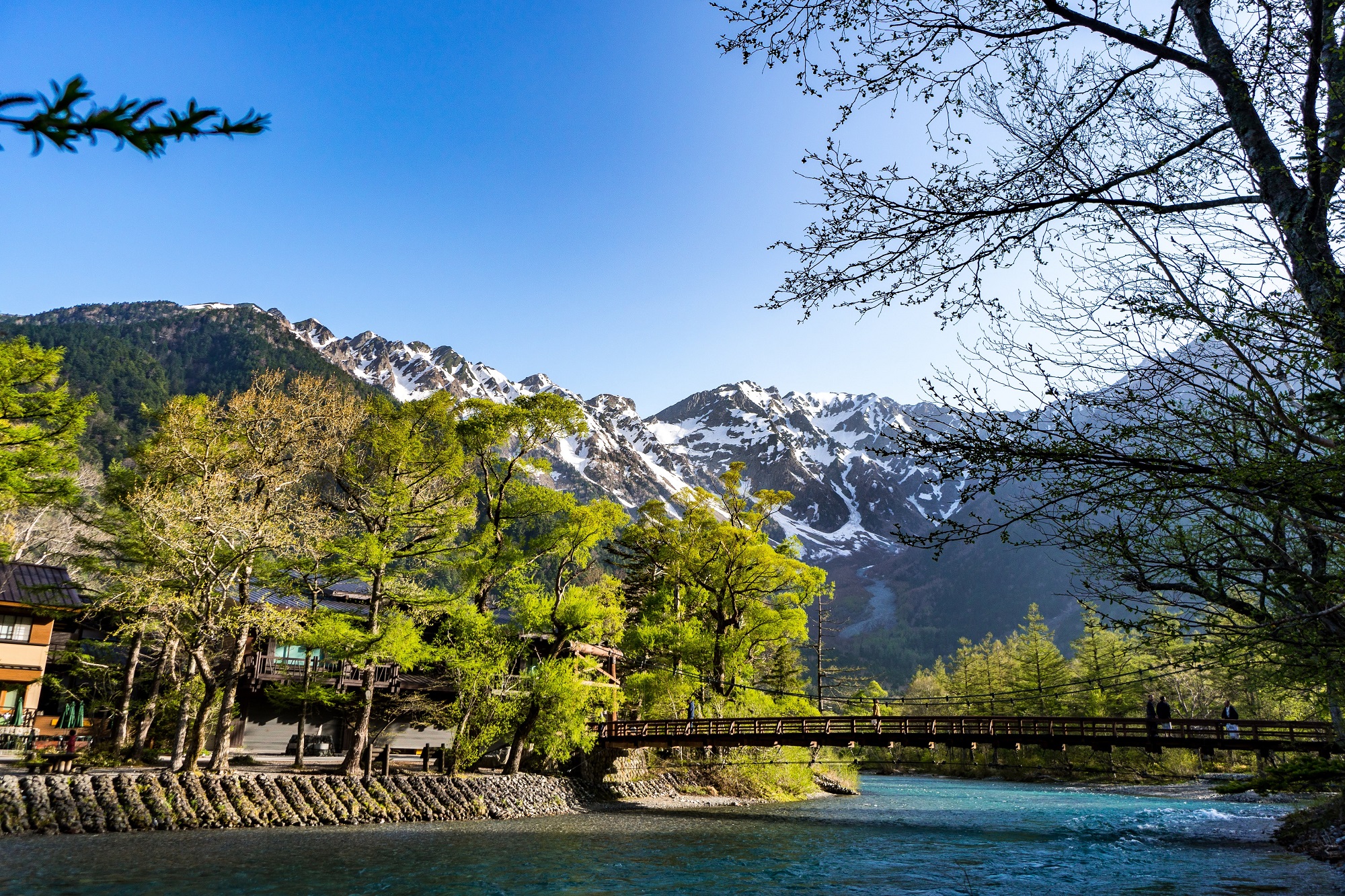
Kamikochi (Matsumoto City)
Kamikochi is a scenic area located 1,500 meters above sea level in the upper reaches of the Azusa River in western Nagano Prefecture. Although 1.2 million people visit the area annually, being a “CAR FREE” [automobile-free] resort, much unspoiled nature remains. The Taisho Pond was created when Mt. Yakedake erupted in 1915, and Kappa Bridge is a suspension bridge and a symbol of Kamikochi. Myojin Pond is surrounded by coniferous trees having impressive scenery. The hiking tour will take about one hour on foot from the starting point at the "Kamikochi Bus Terminal" to Myojin Pond. There is no need to bring full-scale mountaineering gear to Kamikochi, still be sure to wear adequate clothing and bring sufficient supplies and equipment to enjoy hiking safely.
Click here for more on Kamikochi
Gifu
Mt. Norikura (Takayama City)
Kengamine, at 3,026 meters above sea level, is the highest point of the 19 th highest mountain Mt. Norikura, on the border of Gifu Prefecture and Nagano Prefecture, is located close to Matsumoto City. From the summit, capture the views of Mt. Yake-dake, the Hotaka Mountain Range, and Mt. Yari-gatake. The starting point to climb Mt. Norikura is at an elevation of 2,720 meters and is easily accessible by bus or taxi. If not having enough time to climb Kengamine or climbing with small children, try climbing Maōdake instead, of mere 15-minute climb one way. The view of the Northern Japan Alps from the summit is enjoyable. During the summer season, there will be many people waiting for the bus, so, we recommend planning your descent well in advance.
Mie
Kumano Kodo (Shingu City, Tanabe City)
Kumano Kodo is a pilgrimage route that sustained the lives of the people in the past as an ancient road to Kumano, and at the same time, was valued as a pilgrimage route to the Kumano Sanzan [Kumano Hongu Taisha, Kumano Hayatama Taisha, and Kumano Nachi Taisha]. The five routes are Nakahechi, Iseji, Kohechi, Kiiji, and Oheji, and they range from relatively short and easy walks to more advanced routes over several mountains including many spiritual spots based on myths as well as scenic spots with spectacular views. The Iseji route is popular as it begins at Ise Jingu [Shrine] heading to Kumano Sanzan. Of all the walking trails, the Matsumoto-toge Pass connecting Odomari and Kimoto in Kumano City is paved with cobblestone along most of the route and the 5Km stretch surrounded by bamboo forest is the most recommendable route for beginners.
Click here for more on Kumano Kodo
Shiga
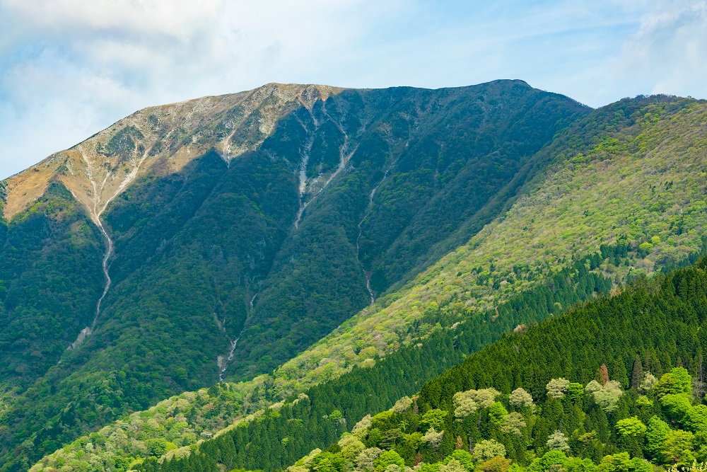
Mt. Ibuki (Maibara)
Mt. Ibuki is located on the border of Shiga Prefecture and Gifu Prefecture and has long been revered as a sacred mountain. Biwako [Lake Biwa], the largest lake in Japan, spreading out to the west of Mt. Ibuki, and the observatory at the summit area has the view of Takefu Island and the Hira Mountains beyond.
The summit may be reached by hiking from the Ninth Station Sky Terrace, which is part of the Ibukiyama Driveway, a road that leads to just below the summit.
*Climbing from the foot of the mountain is prohibited due to rockslides.
Fukui
Araiso Promenade (Sakai City)
Tojinbo is a famous sightseeing spot in Fukui Prefecture with giant columnar rocks stretching along the coastline for about 1Km, and the sight of the rugged waves of the Sea of Japan crushing against the sheer cliffs is just must-see. Araiso Promenade is an excellent hiking course to take a walk while admiring the cliffs of Tojinbo. Walk for 4Km from Komegawaki in Mikuni-cho, through Tojinbo to Oshima, where to enjoy the view of the powerful coast, the blue sea, thick black pine trees, Japanese wild radish flowers in early summer, and monuments of writers and artists associated with Mikuni. Also, there is a place to walk to the tip of the cliff and look down - a moment to be mesmerized by the force of nature. The sunset from Tojinbo is another sight not to be missed.
Click here for more on Tojinbo

Ishikawa
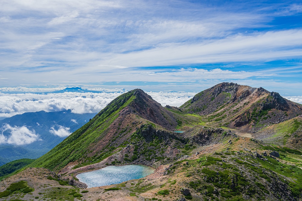
Mt. Hakusan (Hakusan City)
Located on the border of Ishikawa and Gifu Prefecture, Mt. Hakusan is known for one of “Three Holy Mountains” of Japan, along with Mt. Fuji and Mt. Tateyama. "Gozengamine" [Gozen Peak, 2,702m above sea level], is the highest peak of the Mt. Hakusan, and the views of the peaks of the Northern Japan Alps are visible from the summit. Mt. Hakusan has a variety of routes for beginners and advanced climbers. It is possible to walk the mountain on a day trip, and staying overnight in a mountain lodge or a tent for a longer hike is also recommended. The "sunrise", when the sun emerges from the sea of clouds, is a poignant sight as the morning sun shines in all the divine glory. To see this special sunrise, stay at a lodge in Murodo and bring a headlamp and warm clothes in addition to the usual mountaineering gear.
Toyama
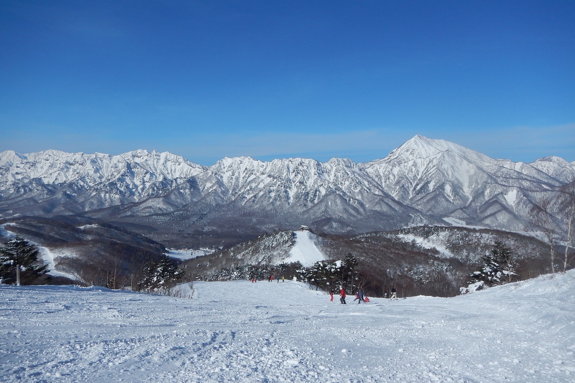
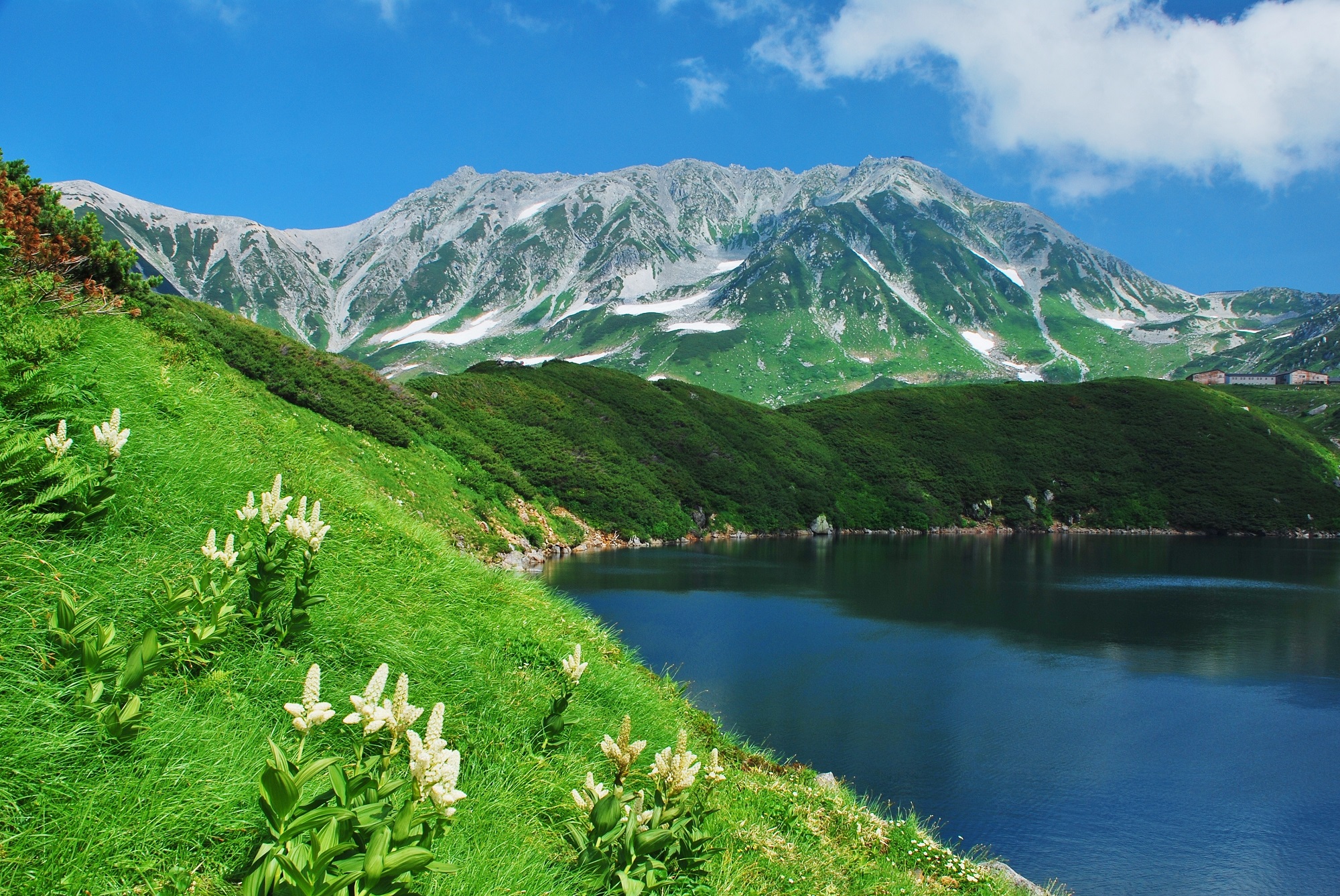
Murodo (Nakaniikawa-gun)
Murodo is located 2,450 meters above sea level on the Tateyama Mountain Range, in the northern part of the Northern Japan Alps. A waypoint along the Tateyama Kurobe Alpine Route and is the best vantage point to view the Tateyama Mountain Range. From Tateyama Station, take cable car and Highland Bus to Murodo for about one hour, and make the most of the many tourist facilities of the inns, stores, restaurants, and onsen [hot springs]. A well-maintained walking trail from the Murodo Terminal to Midagahara is a precious wetland, registered under the Ramsar Convention, for even beginner hikers to enjoy the challenge. As the altitude is over 2,000 meters, be sure to wear appropriate clothing for the season, and prepare belongings and equipment for the hike accordingly.
Click here for more on Tateyama Kurobe Alpine Route

Destinations
Fujisan [Mt. Fuji] / 富士山 (Shizuoka)
Mt. Fuji, the emblem of Japan, is also its tallest mountain. The majestic 3,776-meter-high mountain with its past of frequent and violent eruptions has long been an object of reverence and faith for m....
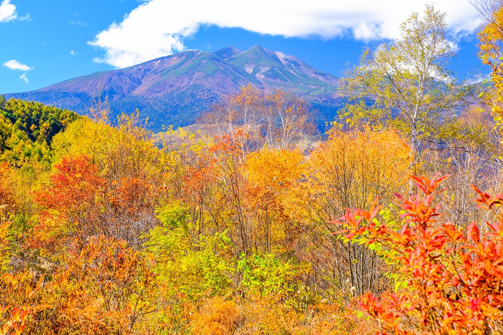
Togakushi / 戸隠 (Nagano)
Togakushi is located in the northwestern part of Nagano City and was once visited by many ascetic practitioners as a sacred site. The area is designated as Myoko-Togakushi renzan National Park, where ....
Kamikochi / 上高地 (Nagano)
Kamikochi is located in the west of Nagano Prefecture, on the border with Gifu Prefecture, at an altitude of about 1,500 meters. Although 1.2 million people visit every year, Kamikochi retains much of....
Kumano Kodo / 熊野古道 (Mie)
The Kii Mountain Range is home to the three sacred sites of Kumano Sanzan (Three Kumano Shrines), Koyasan (Mt. Koya), and Yoshino-and-Omine, which have nurtured various forms of faith, including Shint....
The Tateyama Kurobe Alpine Route / 立山黒部アルペンルート (Toyama)
The Tateyama Kurobe Alpine Route is one of the world's most famous mountain tourism roads, stretching 37.2 km through the 3,000-meter-high peaks of the Northern Alps and connecting Toyama and Nagano p....
News
Latest news and staff posts from Meitetsu World Travel.

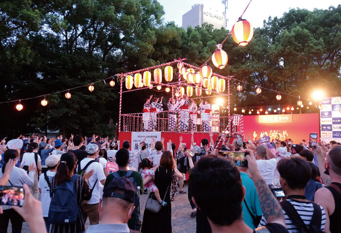
2026.7.16What's new
Osu Summer Festival 2026 Takes Place in Nagoya’s Osu District: Traditional Performances and Cosplay Parades Fill the Streets
2026.7.15What's new
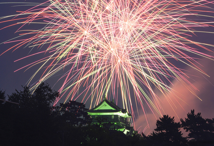
Okazaki Castle Ieyasu Summer Festival Fireworks 2026 Takes Place in Okazaki, Aichi: Around 20,000 Fireworks Light Up the Historic Castle Town

2026.6.25What's new
Toyohashi Gion Festival 2026: Experience Japan’s Most Daring Handheld Fireworks